
Discover how artificial intelligence and location intelligence work together to turn geospatial data into predictive, actionable business decisions.
Artificial Intelligence and Location Intelligence

Every swipe, tap, delivery, and store visit now carries a coordinate. The challenge is no longer collecting location data, it is making sense of it fast enough to act. That is where artificial intelligence and location intelligence meet. Together they transform raw latitude and longitude into decisions that move revenue, cut costs, and reduce risk. In this guide I explain how the two fields combine, where they deliver measurable value, and how to adopt them without wasting budget on tools you will never use.
Quick Answer: Artificial intelligence and location intelligence combine machine learning with geospatial data to reveal where events happen, why, and what comes next. AI analyzes maps, movement, and sensor data at scale, turning coordinates into predictions that guide smarter, faster business decisions.
What Is Location Intelligence?
Location intelligence is the practice of deriving insight from geographic data, such as maps, GPS traces, satellite imagery, and address records. Traditionally, analysts used Geographic Information Systems (GIS) to visualize this data on layered maps. The output was descriptive: it told you what already happened and where.
Artificial intelligence changes the ceiling. Instead of only mapping the past, AI models learn patterns in spatial data and forecast what is likely next. A retailer no longer just sees where customers live, the model predicts which new neighborhood will convert best. This shift, from describing to predicting, is the core reason the two disciplines are now inseparable.
How AI Supercharges Geospatial Data
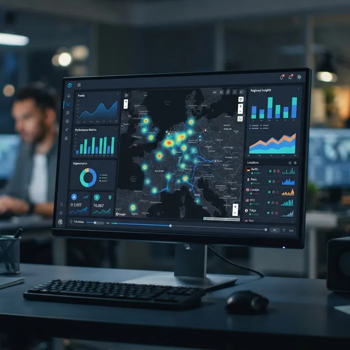
Geospatial datasets are massive, messy, and multidimensional. A single city can generate billions of movement signals per day. Humans cannot review that manually, and traditional GIS software struggles to model relationships hidden across time and space. AI closes that gap in three practical ways.
- Pattern detection at scale: Machine learning clusters millions of points to surface hotspots, anomalies, and trends no analyst would spot by hand.
- Prediction: Models forecast demand, foot traffic, or risk for specific coordinates before events occur.
- Automation: Computer vision reads satellite and drone imagery automatically, classifying roads, crops, rooftops, or flood zones without manual tagging.
According to research cited by MarketsandMarkets, the global location intelligence market is projected to grow from roughly 16 billion dollars in 2021 to over 32 billion dollars by 2026, a signal that organizations increasingly treat spatial data as a strategic asset rather than a mapping novelty.
Key Terms Defined
- Geospatial data: Any data tied to a specific location on Earth, expressed through coordinates, addresses, or regions.
- Machine learning: A branch of AI where systems learn patterns from data and improve predictions without explicit programming.
- Spatial prediction: Using models to estimate an outcome, such as demand or risk, for a given place and time.
Machine Learning Meets Mapping

The most powerful applications appear when models are trained specifically on spatial relationships. Geographic data breaks a core assumption of many algorithms, that data points are independent. In reality, near things are more related than distant things, a principle known as spatial autocorrelation. Modern AI handles this with geospatial neural networks and graph models that treat neighborhoods, roads, and regions as connected systems.
In my experience advising teams on analytics adoption, the projects that succeed start narrow. One logistics client did not try to "do AI for everything." They trained a single model to predict which delivery routes would run late based on weather, traffic history, and location density. That focused model cut late deliveries measurably within one quarter because it answered one clear question well.
If you want expert help turning that kind of spatial data into working models, the artificial intelligence services from ZoneTechify are built for exactly these use cases, and you can explore the full agency at ZoneTechify.
Real-Time Location Tracking With AI

Static maps are giving way to living ones. AI now ingests live GPS, IoT sensor, and mobile signal feeds to update its understanding of the world continuously. This matters most in operations where seconds cost money.
- Fleet and logistics: Models reroute drivers around congestion in real time, balancing fuel, time, and delivery windows.
- Retail and hospitality: Live foot-traffic analysis adjusts staffing and promotions on the fly.
- Public safety: Real-time anomaly detection flags unusual crowd or vehicle movement for faster response.
Google has reported that its AI-driven routing features help reduce fuel use and emissions across billions of trips, a concrete example of location intelligence producing environmental and cost benefits simultaneously. The lesson for businesses is clear: real-time spatial AI is no longer experimental, it is operational.
Predictive Location Analytics in Action

Prediction is where location intelligence earns its budget. Rather than reacting, organizations anticipate. A few high-value patterns I see repeatedly:
- Site selection: Retailers and restaurants use demographic, mobility, and competitor data to score potential locations before signing a lease.
- Demand forecasting: Delivery and rideshare platforms predict where orders will spike, positioning supply in advance.
- Risk modeling: Insurers combine flood maps, wildfire history, and climate data to price policies by precise location rather than broad zip codes.
These models reduce guesswork. Instead of opening five stores and hoping two work, a chain can rank fifty candidate sites by predicted revenue and open the three most likely to succeed. That is the difference between spending on intuition and investing on evidence.
AI Location Intelligence vs Traditional GIS

Many teams already own GIS software and wonder whether AI replaces it. It does not, it extends it. The table below compares the two approaches so you can decide where to invest.
| Capability | Traditional GIS | AI Location Intelligence |
|---|---|---|
| Primary output | Descriptive maps | Predictive insights |
| Data volume | Moderate, structured | Massive, mixed sources |
| Time focus | Past and present | Present and future |
| Automation | Mostly manual analysis | Automated detection and forecasting |
| Imagery analysis | Manual interpretation | Computer vision at scale |
| Best for | Visualization and reporting | Prediction and decision support |
The practical takeaway: keep your GIS for visualization and compliance, and layer AI on top for forecasting and automation. The two are complementary, not competing.
How to Start Using AI Location Intelligence
Adopting this technology does not require a research lab. Follow a disciplined path.
- Define one question: Start with a specific, measurable problem such as "where should we place our next warehouse?"
- Audit your data: Confirm you have clean location data tied to outcomes like sales, delays, or claims.
- Choose the right tools: Combine a GIS platform with a machine learning framework, or partner with a specialist team.
- Build a small model: Validate predictions against real results before scaling.
- Operationalize: Feed insights into dashboards and workflows people actually use daily.
Teams that skip step one and buy tools first almost always stall. The technology is rarely the bottleneck, unclear objectives are. For businesses that want a partner across strategy and implementation, WebPeak and its artificial intelligence services can help you move from raw data to deployed models.
The Future of Location Intelligence

The next wave blends location intelligence with generative AI and autonomous systems. Expect natural-language interfaces where a manager simply asks, "which regions will drive growth next quarter?" and receives a mapped, explained answer. Autonomous vehicles, drones, and smart-city sensors will feed continuous spatial data into models that manage traffic, energy, and logistics with minimal human input.
Privacy will shape this future heavily. Responsible organizations already anonymize and aggregate location data to protect individuals while preserving analytical value. The winners will be those who earn trust, not just those with the most data. Location intelligence is becoming a default layer of business strategy, much like the internet became a default layer of communication.
Key Takeaways
- Artificial intelligence turns location data from descriptive maps into predictive, actionable insight.
- The location intelligence market is projected to surpass 32 billion dollars by 2026, reflecting rapid adoption.
- AI adds three core capabilities to geospatial data: pattern detection, prediction, and automation.
- Spatial autocorrelation means AI models must treat locations as connected, not independent.
- Traditional GIS and AI are complementary, use GIS for visualization and AI for forecasting.
- Successful adoption starts with one clear, measurable question and clean, outcome-linked data.
Frequently Asked Questions (FAQ)
What is the difference between AI and location intelligence?
Location intelligence analyzes geographic data to reveal where things happen. Artificial intelligence adds learning and prediction. When combined, AI processes massive spatial datasets to forecast future events by location, moving beyond simple mapping into automated, predictive decision-making that guides real business strategy.
How is AI used in geospatial analysis?
AI is used to detect patterns in huge location datasets, forecast demand or risk for specific places, and automatically classify satellite and drone imagery using computer vision. It handles data volumes and spatial relationships that traditional manual GIS analysis simply cannot process quickly or accurately.
Which industries benefit most from location intelligence?
Retail, logistics, insurance, real estate, telecommunications, and public safety benefit most. They use it for site selection, route optimization, risk pricing, and demand forecasting. Any business whose outcomes depend on where customers, assets, or risks are located can gain measurable value from AI-driven spatial insight.
Do I need to replace my GIS software to use AI?
No. AI extends GIS rather than replacing it. Keep your GIS platform for visualization, mapping, and compliance reporting, then layer machine learning on top for prediction and automation. The two systems work best together, with GIS handling display and AI handling forecasting.
Is location data collection a privacy concern?
Yes, and it must be handled responsibly. Trusted organizations anonymize and aggregate location data so individuals cannot be identified while insights remain useful. Following privacy regulations and being transparent about data use builds customer trust, which is essential for sustainable location intelligence programs.